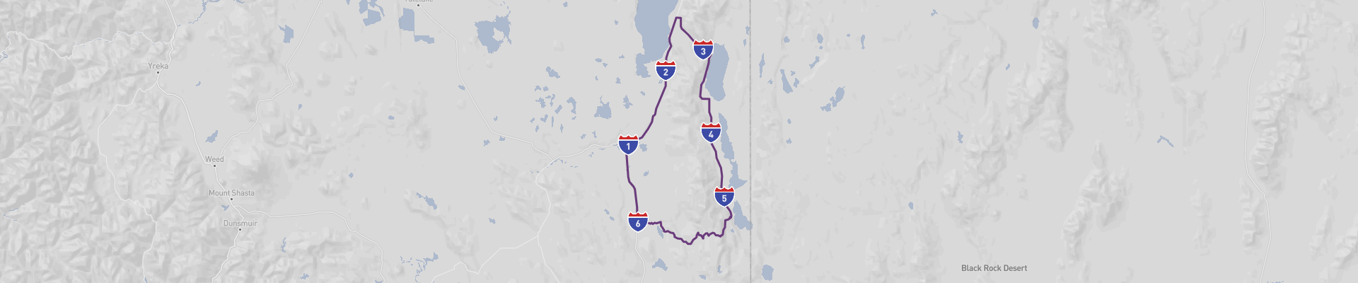
Alturas Panoramic Road Itinerary
The Alturas Panoramic Road Trip is an exciting journey through the heart of the United States. Starting in Alturas, the 230km route takes you through Davis Creek, Cedarville, and Likely. Along the way, you can enjoy stunning views of the countryside and a variety of attractions. The best time to experience this road trip is during the summer months, when the roads are in the best condition and the scenery is most vibrant.
The overall road conditions are good, although some parts of the route can be narrow and curvy. Please be aware that seasonal road closures due to weather conditions may occur.
This road trip is suitable for all drivers, and can be managed on a moderate budget. It provides a high level of experience and memories that will last a lifetime. So come and explore the Alturas Panoramic Road Trip!
 1
number of days
1
number of days
 230 km
route length
230 km
route length
 fair
budget
fair
budget
 explorer
good for
explorer
good for
 on the right
traffic direction
on the right
traffic direction
 fair
accident level
fair
accident level
START
Alturas
Distance 230 km
Driving time 7.3 h
Pace: slow
52.9 kWh
Airports
RDD
[detailsContainer]
Alturas, located in Northeastern California, is a small town with an incredible view of the Warner Mountains. It is the perfect starting point for a road trip along the "Alturas Panoramic Road" – a scenic drive that takes you through the breathtaking landscapes of Modoc County. As you travel through the countryside, you will be mesmerized by the spectacular view of the surrounding mountains, the rolling hills, the wildflower fields, the winding rivers, and the rich wildlife.
The town of Alturas is home to some of the most interesting sights to visit. The Modoc County Historical Museum is a great place to learn about the history of the area and the Shasta Valley Wildlife Refuge is a great place to observe the local wildlife. For those looking to explore the outdoors, there is the Hat Creek Recreation Area, which offers hiking, mountain biking, and fishing.
For those travelling to Alturas by air, the nearest international airport is Reno-Tahoe International Airport (RNO). This airport offers car rental services and is the perfect starting point for your road trip. So, get ready to embark on an unforgettable journey along the Alturas Panoramic Road!
1
Alturas
- Davis Creek
Distance 33 km
Driving time 0.4 h
Pace: fast
10.0 kWh
↓
View map
↓
Itinerary
[detailsContainer]
Embark on a memorable road trip from Alturas to Davis Creek! This 21-mile journey will take you less than an hour to complete, and you’ll be amazed by the sights along the way. Be aware that the road can be narrow in sections, so please drive carefully.
In Alturas, make sure to visit the Modoc County Museum and explore the fascinating history of the area. Then, in Davis Creek, you can explore the Modoc National Forest and take in the breathtaking views of the surrounding nature.
For more information about attractions, accommodation options, recommended restaurants, and campsites along the route, please refer to the "Itinerary" of this stage. Enjoy your journey!
 Davis Creek - United States - North America - Scenic Drive - Wikimedia Commons
❯
❮
2
Davis Creek
- Fandango Pass
Distance 39 km
Driving time 0.7 h
Pace: modest
10.1 kWh
↓
View map
↓
Itinerary
[detailsContainer]
Are you ready for an exciting road trip from Davis Creek to Fandango Pass? This 24-mile journey will take you less than an hour to complete. As you make your way through this scenic road, you will come across some steep ramps, winding roads and narrow sections. Keep an eye out as some sections may be closed seasonally. With so much to explore, your journey will be filled with excitement. The most interesting places to visit along the way are the Davis Creek Reservoir, the Fandango Pass Lookout and the Fandango Pass Wildlife Refuge. For more information about attractions, accommodation options, recommended restaurants and campsites along the route, please refer to the Itinerary of this stage. So, what are you waiting for? Let's hit the road!
Fandango Pass - United States - North America - Scenic Drive - Wikimedia Commons
❯
❮
3
Fandango Pass
- Cedarville
Distance 40 km
Driving time 0.7 h
Pace: modest
10.3 kWh
↓
View map
↓
Itinerary
[detailsContainer]
Begin your road trip in Fandango Pass, United States and explore the beauty of Cedarville. Spanning only 25 miles, the journey takes less than an hour and is full of scenic views. Along the way, you can enjoy the winding roads and narrow sections. During the winter, some sections may be closed seasonally, so be sure to check the conditions before you go. As you drive, take in the breathtaking sights and enjoy the fresh air. Once you arrive in Cedarville, you can explore the many attractions and activities the town has to offer. For more information on things to do and places to stay, be sure to consult the Itinerary of this stage. So, what are you waiting for? Pack your bags and get on the road to Fandango Pass and Cedarville!
Cedarville - United States - North America - Scenic Drive - pixabay.com
❯
❮
4
Cedarville
- Eagleville
Distance 25 km
Driving time 0.4 h
Pace: fast
7.5 kWh
↓
View map
↓
Itinerary
[detailsContainer]
Are you ready for an amazing road trip from Cedarville to Eagleville? This 16mi journey will take you less than 1 hour to complete and you will be able to enjoy the scenic road along the way. Some sections of the route may be closed seasonally, so please pay attention to the signs. On your way, you will find some of the most interesting places to visit, such as the Cedarville State Forest, where you can explore the outdoors and take in the natural beauty of the area. Then, you can stop at the Eagleville Dam, where you can admire the stunning views of the lake. You can also take a break at the Eagleville Beach, where you can relax and enjoy the sun. For more information regarding attractions, accommodation options, recommended restaurants, and campsites along the route, please refer to the "Itinerary" of this stage. So, what are you waiting for? Pack your bags and start your journey today!
Eagleville - United States - North America - Scenic Drive - Wikimedia Commons
❯
❮
5
Eagleville
- Likely
Distance 63 km
Driving time 4.8 h
Pace: slow
14.4 kWh
↓
View map
↓
Itinerary
[detailsContainer]
Are you ready for an unforgettable road trip from Eagleville to Likely? This scenic route is only 39 miles long and takes less than 5 hours to drive. Although some sections of the road may be closed seasonally, this route offers some of the most beautiful views of the countryside. You will pass through winding roads, narrow roads, and some of the most stunning landscapes. Along the way, you can enjoy the sights of Eagleville and Likely, two of the most interesting places to visit. Eagleville is home to the Eagleville Historic District, a National Historic Landmark, and the Likely Covered Bridge, the longest covered bridge in California. Likely is home to the Likely Mountain Lookout, with its spectacular views of the surrounding area. Be sure to pay attention to the road, as some sections may be winding and narrow. For more information on attractions, accommodation options, recommended restaurants, and campsites along the route, please refer to the “Itinerary” of this stage. So, buckle up and enjoy the ride!
Likely - United States - North America - Scenic Drive - Wikimedia Commons
Likely - United States - North America - Scenic Drive - Wikimedia Commons
❯
❮
6
Likely
- Alturas
Distance 30 km
Driving time 0.3 h
Pace: fast
9.0 kWh
↓
View map
↓
Itinerary
[detailsContainer]
Welcome, road-trippers! This stage of your road trip starts in Likely, United States and ends in Alturas, 19mi away. It's a short drive, taking less than an hour, so you can enjoy the sights and sounds of the area without having to rush.
Starting in Likely, you can visit the Likely Mountain Lookout, an old fire lookout tower with an incredible view of the valley. The Likely Valley Museum is also a must-see, for its unique collection of artifacts and history of the area.
When you arrive in Alturas, be sure to check out the Modoc County Museum, a great place to learn about the history and culture of the region. You can also visit the Alturas Wildlife Refuge, a beautiful area with plenty of bird watching opportunities.
These are just a few of the attractions you can visit along this route. For more information about attractions, accommodation options, recommended restaurants, and campsites, please refer to the “Itinerary” section of this stage. Enjoy the ride!
Alturas
[detailsContainer]
Alturas, located in the north of California, is a beautiful town, filled with a diverse culture and history. It is the perfect ending point of the stunning “Alturas Panoramic Road” road trip. Alturas is a place of many wonders that are waiting to be explored.
Begin your exploration with a visit to the Modoc County Museum. Here you can learn about the history and culture of the area, and see some of the artifacts that have been preserved since the 1800s. You can also explore the lovely Susanville Ranch Park, which is filled with lush vegetation and a variety of wildlife.
Alturas also offers a variety of outdoor activities. Hike through the picturesque Warner Mountains or go fishing in the nearby lakes. There are also many interesting rock formations to explore, and a variety of wildlife to observe.
End your road trip with a visit to the charming main street, where you can find many unique shops and restaurants. Enjoy a delicious meal and take a stroll down the quaint streets. There is something for everyone in Alturas.
For those traveling by air, the closest international airport is Reno-Tahoe International Airport (RNO). From there, you can easily rent a car and continue your journey to Alturas.
Alturas is the perfect destination for a road trip. With its rich culture and history, stunning landscape, and plethora of activities, it is an ideal destination for a memorable vacation.
Alturas Panoramic Road at a glance
-
Start:
Alturas
-
End:
Alturas
-
Distance:
230 km
-
Stay:
1 day
-
Getting there:
Redding Municipal Airport (RDD)
-
When to drive:
May, June, July, August, September
-
More info:
More info you can find in the "Itinerary" section at each stage.
Before you set off
The Alturas Panoramic Road Trip is a captivating journey through the diverse landscapes of Northern California. Spanning approximately 230km (143 miles), this route takes you from the charming town of Alturas through a series of natural wonders and historic communities such as Davis Creek, Cedarville, and Likely, offering a deep dive into America's scenic beauty and cultural heritage.
Key Destinations and Top Sights:
- Alturas: As the starting point, Alturas is not only the county seat of Modoc County but also a gateway to the Modoc National Wildlife Refuge, where birdwatching opportunities abound, especially for spotting migratory waterfowl.
- Davis Creek: Known for its proximity to the stunning Goose Lake, Davis Creek is a haven for outdoor enthusiasts looking to fish, camp, or simply soak in the serene vistas.
- Cedarville: This town is at the heart of the Surprise Valley, where visitors can explore the High Desert State Park, discover Native American petroglyphs, and learn about the area's ranching history.
- Likely: Nestled in a valley, Likely boasts a picturesque golf course and access to the Warner Mountains, providing a perfect backdrop for relaxation and nature exploration.
Best Time to Go:
Late spring through early fall is ideal for the Alturas Panoramic Road Trip, with June to September offering the most favorable weather conditions. This period showcases the region's wildflowers, wildlife, and the Warner Mountains in full splendor.
Potential Risks:
While the journey is scenic, travelers should be prepared for sudden weather changes, particularly in the higher elevations where conditions can shift rapidly. Be mindful of wildlife crossing the Roads and keep an eye out for livestock in rural areas.
Facts for Roadtrippers:
- The entire route can typically be driven in a day, but allowing several days lets you fully enjoy each destination.
- The Road is paved throughout, with some stretches less traveled, providing a sense of solitude amidst nature.
- Attractions along the way cater to a wide range of interests, from historical landmarks and museums to hiking trails and hot springs.
A good choice for:
The Alturas Panoramic Road Trip is an enchanting experience for those who appreciate the Road less traveled. Its combination of natural splendor, wildlife encounters, and cultural insights make it a rewarding adventure. By traveling during the warmer months and making time to explore beyond the pavement, Roadtrippers will forge lasting memories on this distinctive Northern California excursion.
 -
-