Baja California Road Trip Itinerary
The Baja California Road Trip is the perfect way to explore the beauty of the western coast of North America. Starting in Los Angeles, USA, the route takes you south through San Diego, Ensenada, Guerrero Negro, Todos Santos, and Los Mochis, Mexico, before arriving in Creel. The total distance is 2753km, and it should take about 14 days to complete. The best time of year for this trip is generally in the winter, as the temperatures are mild and you'll get to experience some of the best landscapes and beaches the region has to offer. The road conditions along the way are great, with only a few sections of narrow and curvy roads. This road trip is suitable for drivers of all levels, and can be done on a moderate budget. Whether you're an experienced traveller or a beginner, the Baja California Road Trip will provide an unforgettable experience and lasting memories.
 14
number of days
14
number of days
 2,746 km
route length
2,746 km
route length
 fair
budget
fair
budget
 family
good for
family
good for
 on the right
traffic direction
on the right
traffic direction
 moderate
accident level
moderate
accident level
START
Los Angeles
Distance 2,746 km
Driving time 50.1 h
Pace: modest
713.9 kWh
Airports
LAX
,
SNA
[detailsContainer]
Los Angeles is the perfect place to start the “Baja California Road Trip”. With its sunny days, warm weather, and beautiful beaches, this city is a great kick off point for any road trip.
Los Angeles is full of sights to see and places to explore. The Hollywood Walk of Fame, Universal Studios, and the Hollywood Sign are just some of the iconic attractions the city has to offer. The Getty Center museum is a must-see for any art enthusiast, and the Griffith Observatory is a great spot to take in the stunning views of the Los Angeles skyline.
For those traveling by air, the closest international airport is the Los Angeles International Airport (IATA: LAX). Car rentals are available at this airport, giving visitors the flexibility to explore as much of Los Angeles as they wish.
With its diverse attractions, warm weather, and easy access to car rentals, Los Angeles is the perfect place to start the “Baja California Road Trip”. Whether exploring the city’s famous attractions or simply soaking up the sun, Los Angeles is sure to be a memorable start to any road trip.
1
Los Angeles
- San Diego
Distance 200 km
Driving time 2.7 h
Pace: fast
59.9 kWh
↓
View map
↓
Itinerary
[detailsContainer]
Greetings road-trippers! Ready for an exciting adventure from Los Angeles to San Diego? This stage of your journey is a 194 km drive that can be done in under 3 hours. We suggest you check out some of the most interesting places along the way. Start with the famous Griffith Observatory in Los Angeles which offers stunning views of the city and beyond. Then, make a stop at the San Juan Capistrano Mission in San Juan Capistrano. Here, you can learn about the history of the mission and its role in the California Missions Trail. Further down the road, you can visit the USS Midway Museum in San Diego. This is a great place to explore naval history and get a glimpse of life on an aircraft carrier. Finally, make sure to check out the beautiful Balboa Park. With its lush gardens, museums, and Spanish Colonial Revival architecture, it's a must-see destination. More information regarding attractions, accommodation options, recommended restaurants, and campsites along the route is available in the "Itinerary" of this stage. So, get ready to hit the road and have a blast!
 San Diego - United States - North America - Road Trip - Wikimedia Commons
San Diego - United States - North America - Road Trip - www.flickr.com
❯
❮
2
San Diego
- Tijuana
Distance 30 km
Driving time 0.5 h
Pace: fast
8.9 kWh
↓
View map
↓
Itinerary
[detailsContainer]
Are you ready for a fantastic road trip to explore two vibrant cities, San Diego and Tijuana? This is one of the most interesting stages of your journey, only 30 km apart and with a driving time of less than 1 hour.
In San Diego, you can visit the famous Balboa Park, home to numerous attractions, such as the San Diego Zoo, and the world-renowned museums. Or take a stroll around the harbor and enjoy a stunning view of the city skyline.
When you arrive in Tijuana, you'll find a bustling city full of life and culture. Don't miss the opportunity to explore the unique shops, galleries, and restaurants. Plus, you can take a tour of the Monumental Arch, and the nearby beaches.
For more information about attractions, accommodation options, recommended restaurants, and campsites along the route, check out the "Itinerary" of this stage. Get ready for a unique experience!
Tijuana - United States - North America - Road Trip - Pixabay
❯
❮
3
Tijuana
- Ensenada
Distance 103 km
Driving time 1.6 h
Pace: fast
31.0 kWh
↓
View map
↓
Itinerary
[detailsContainer]
Welcome road-trippers! Are you ready for a thrilling and memorable experience? The stage of your road trip that starts in Tijuana, Mexico and ends in Ensenada is a 112km stretch that can be completed in fewer than 2 hours.
Begin your journey in Tijuana and visit the Historic Center with its bustling markets and shops. Then, take a break at Playas de Tijuana, the city’s most popular beach. You will find great restaurants, cafes, and bars here.
Continue your journey towards Ensenada and make a stop at the La Bufadora, an impressive marine geyser that can be observed from a platform. Be sure to check out the souvenir shops in the area.
Once you arrive to Ensenada, you should not miss the chance to explore the area's beautiful vineyards and wineries. Also, visit the boardwalk and take a stroll along the waterfront.
Finally, you can wrap up your road trip stage by visiting the La Punta Lighthouse, a spectacular and historic site.
For more information regarding attractions, accommodation options, recommended restaurants, and campsites along the route, please refer to the itinerary of this stage. Enjoy your journey!
Ensenada - United States - North America - Road Trip - - Wikimedia Commons
❯
❮
4
Ensenada
- Catavina
Distance 369 km
Driving time 5.3 h
Pace: fast
110.8 kWh
↓
View map
↓
Itinerary
[detailsContainer]
Let's start the road trip! The stage begins in Ensenada, Mexico, located on the Pacific coast. The first stop on the route is the Mission of San Miguel Arcangel, built in 1780. It is a beautiful example of the California missions. Next, we'll drive through the scenic mountain range of Sierra de San Pedro Mártir, where you can observe the desert landscape and, if you are lucky, wildlife. After that, we will reach the town of Catavina, located at the heart of the Baja Peninsula. There are many interesting attractions to explore here, such as the Las Cuevas de Catavina rock formation, the San Borja Mission, and the Torre de Santa Inés viewpoint. The total distance of this stage is 369 km and the driving time is fewer than 6 hours. Enjoy the ride and pay attention to the scenic road! For more information regarding attractions, accommodation options, recommended restaurants, and campsites along the route, please check the "Itinerary" of this stage.
Catavina - United States - North America - Road Trip - Pixabay
❯
❮
5
Catavina
- Guerrero Negro
Distance 236 km
Driving time 3.1 h
Pace: fast
70.7 kWh
↓
View map
↓
Itinerary
[detailsContainer]
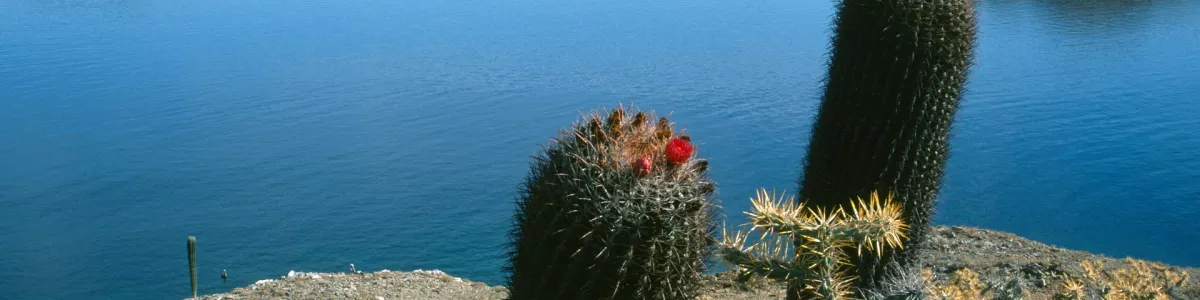
Take the wheel and embark on a road trip from Catavina to Guerrero Negro! Get ready to experience the beauty of the Baja California Peninsula while driving along the 236 km of picturesque landscapes and scenic roads. You will pass by impressive rock formations and cactus-filled plains, and in less than 4 hours you will arrive at your destination.
On your way, you can take a break in the magical town of San Ignacio and enjoy its historical mission, or you can marvel at the breathtaking views of La Purísima Mission. If you have some time, you should stop and explore the ruins of Santa Rosalia, a former mining town that was abandoned in the 1980s.
At the end of your journey, you will arrive to Guerrero Negro, which is known for its salt production. Here you can visit the Ojo de Liebre Lagoon and spot some of the thousands of gray whales that live in this area.
Don’t forget to consult our “Itinerary” for this stage in order to find out more information about attractions, accommodation options, recommended restaurants, and campsites along the route. Enjoy your road trip!
Guerrero Negro - United States - North America - Road Trip - Pixabay
❯
❮
6
Guerrero Negro
- Loreto
Distance 415 km
Driving time 5.4 h
Pace: fast
124.6 kWh
↓
View map
↓
Itinerary
[detailsContainer]
Embark on a road trip from Guerrero Negro, Mexico to Loreto and explore fascinating attractions along the way! This 415 km journey will take you fewer than 6 hours, but you will want to linger at all the captivating sights. Visit the lovely Mission of San Javier, where you can admire its sacred beauty and learn about its history. Continue your journey and you will arrive at the mesmerizing Laguna Ojo de Liebre, a unique natural reserve with stunning landscapes. On the way, you will also find the charming San Ignacio Lagoon, where you can take a boat tour and watch the playful whales. The picturesque village of San Ignacio is also worth a stop. Finally, you will arrive at Loreto, a charming destination with plenty of attractions. Don't miss the Mission of Nuestra Señora de Loreto, a stunning religious building. You will find more information about attractions, accommodation options, recommended restaurants, and campsites along the route in the "Itinerary" of this stage. Have a great road trip!
Loreto - United States - North America - Road Trip - commons.wikimedia.org
❯
❮
7
Loreto
- Todos Santos
Distance 434 km
Driving time 5.5 h
Pace: fast
130.1 kWh
↓
View map
↓
Itinerary
[detailsContainer]
Are you ready for an epic road trip adventure from Loreto to Todos Santos? This 434km journey will take you less than 6 hours, and you will be rewarded with some of the most spectacular views and fascinating historical sites along the way!
Start your journey in Loreto, located on the coast of the Sea of Cortez. Here you can explore the old mission of Nuestra Señora de Loreto Conchó, built in 1697. You can also take a boat tour to the nearby Isla Coronado.
Continue your journey to La Paz, where you can admire the beauty of the Sea of Cortez and the majestic Sierra de la Laguna Mountains. Be sure to visit the Malecon Boardwalk and the San Francisco Church.
Further along your journey, you will reach Santiago, where you can explore the remains of a Prehispanic settlement and the Santiago Mission.
Finally, you will arrive in Todos Santos, known for its art galleries, restaurants, and local shops. Here you can also visit the old mission of Nuestra Señora del Pilar, built in 1734.
Be sure to keep your eyes open for picturesque landscapes and scenic roads along your journey! For more information about attractions, accommodation options, recommended restaurants, and campsites along the route, check out the “Itinerary” of this stage. Enjoy your trip!
Todos Santos - United States - North America - Road Trip - - Wikimedia Commons
❯
❮
8
Todos Santos
- La Paz
Distance 339 km
Driving time 7.4 h
Pace: modest
88.0 kWh
↓
View map
↓
Itinerary
[detailsContainer]
Embark on an unforgettable road trip from Todos Santos to La Paz! This 343km journey will take you less than 8 hours to complete. Along the way, you will enjoy beautiful landscapes, winding roads, and narrow sections. Make sure to keep your eyes peeled for interesting sights and sounds! As for places to visit, start your journey in Todos Santos and explore its historical sites and its stunning beaches. Then, make your way to La Paz and marvel at its incredible architecture, its bustling streets, and its cultural activities. For those who want to stay longer, there are plenty of accommodation options, delicious restaurants, and amazing campsites to choose from. For more information regarding attractions, accommodation, and other activities, please refer to the Itinerary of this stage. Enjoy your road trip!
La Paz - United States - North America - Road Trip - Wikimedia Commons
La Paz - United States - North America - Road Trip - Wikipedia
❯
❮
9
La Paz
- Los Mochis
Distance 248 km
Driving time 8.3 h
Pace: slow
57.0 kWh
↓
View map
↓
Itinerary
[detailsContainer]
Get ready for an exciting road trip from La Paz to Los Mochis! This 248km journey takes less than 9 hours and offers plenty of picturesque landscapes and stunning views. You'll cross the Sea of Cortez by ferry, so don't miss out on this unique experience. As you drive through, keep an eye out for the spectacular vistas and quaint towns along the way. Make sure to visit the beautiful San Ignacio lagoon, where you can marvel at the vast expanse of water and admire the unique wildlife. Also, don't miss the chance to explore the charming city of El Fuerte. This is just one stage of the larger tour, so be sure to explore more of the area. For more information about attractions, accommodation options, recommended restaurants, and campsites along the route, check out the Itinerary of this stage. Have a safe and enjoyable journey!
10
Los Mochis
- El Fuerte
Distance 85 km
Driving time 1.5 h
Pace: modest
22.1 kWh
↓
View map
↓
Itinerary
[detailsContainer]
Embark on an amazing road trip from Los Mochis to El Fuerte, an 85 km journey that takes less than two hours! Along the way, you'll get to admire the beautiful landscape of the Sierra Madre Mountains, as well as the historical sites that line the path. Make sure to keep your eyes open for the winding roads and narrow sections that you'll encounter. Don't forget to take a break to appreciate the stunning view of the 'Cerro de la Quemada' and 'Cerro del Mirador'. To top it off, you'll reach El Fuerte, a beautiful colonial-style city that is known for its cobblestone streets, stunning architecture, and delicious food. For more information on attractions, accommodation, and other points of interest along the route, check out the Itinerary section of this stage. Enjoy your road trip!
El Fuerte - United States - North America - Road Trip - commons.wikimedia.org
❯
❮
11
El Fuerte
- Creel
Distance 288 km
Driving time 8.8 h
Pace: slow
66.2 kWh
↓
View map
↓
Itinerary
[detailsContainer]
Are you ready for a spectacular road trip from El Fuerte to Creel? This journey is full of breathtaking landscapes, historical sites, and winding roads. You'll be covering 288 km in less than 9 hours, so you'll have plenty of time to take in the views. As you make your way through the Sierra Madre Mountains, keep your eyes peeled for steep ramps and narrow roads. You'll be able to take in the picturesque views and get a taste of the local culture. Visit El Fuerte's historic center, the Casa de Coronel, and the ancient petroglyphs of Los Petroglifos. In Creel you can explore the barranca of the Copper Canyon, the old train station, and the temple of the Mennonite church. For more information on attractions, accommodation options, recommended restaurants, and campsites along the route, check out the Itinerary for this stage. So, what are you waiting for? Pack your bags and hit the road!
Creel - United States - North America - Road Trip - - Wikimedia Commons
❯
❮
Creel
[detailsContainer]
At the end of your "Baja California Road Trip" lies the vibrant and picturesque town of Creel. Nestled in the Sierra Tarahumara Mountains, it's the ideal spot to relax and explore the surrounding natural beauty.
Creel is known for its unique fusion of Mexican and Tarahumara culture. Here you can find traditional Tarahumara artisans selling their handmade goods in the markets, as well as restaurants offering delicious regional cooking.
The town itself is a great spot to explore, with its cobblestone streets lined with colorful buildings and plenty of local shops and eateries. Be sure to check out the local museum with its collection of Tarahumara artifacts and art. You can also take a hike up the nearby Cerro Mohinora for amazing views of the valley below.
For those looking to explore further afield, the nearby Barranca del Cobre Canyon offers plenty of opportunities for adventure. The canyon is home to some of the most spectacular waterfalls in the area, as well as several hiking trails and rock climbing routes.
For those who prefer to travel by air, the closest international airport is located in Chihuahua, Mexico (IATA: CUU). From there, you can take a bus or rent a car to take you to Creel.
So, at the end of your "Baja California Road Trip," make sure you stop in Creel to experience its unique culture and explore the stunning natural surroundings.
Baja California Road Trip at a glance
-
Start:
Los Angeles
-
End:
Creel
-
Distance:
2,746 km
-
Stay:
14 days
-
Getting there:
Los Angeles International Airport (LAX),
John Wayne Airport-Orange County Airport (SNA)
-
When to drive:
January, February, March, April, September, October, November, December
-
More info:
More info you can find in the "Itinerary" section at each stage.
Before you set off
The Baja California Road Trip is a remarkable adventure along the breathtaking western coast of the Baja California Peninsula, commencing in the vibrant city of Los Angeles, USA, and winding down to the serene town of Creel in Chihuahua, Mexico. Stretching over a distance of 2753km (approximately 1711 miles) and ideally savored over a span of 14 days, this epic journey is a treasure-trove of awe-inspiring natural beauty, rich cultural encounters, and a plethora of activities to suit every traveler.
Key Destinations and Top Sights:
- Los Angeles: Discover the glitz and glam of Hollywood, relax on the iconic Santa Monica Beach, and enjoy panoramic city views from the Griffith Observatory.
- San Diego: Explore the cultural heart of Balboa Park, visit the world-famous San Diego Zoo, and step aboard the historic USS Midway Museum.
- Ensenada: Witness the powerful La Bufadora blowhole, indulge in the local wine culture, and savor fresh seafood at bustling markets.
- Guerrero Negro: Experience the magic of gray whale watching in Scammon's Lagoon, particularly from December to April during their migration season.
- Todos Santos: Catch waves at the renowned Los Cerritos beach, peruse vibrant art galleries, and uncover the myths of the legendary Hotel California.
- Los Mochis: The starting point for the enthralling train journey through the majestic Copper Canyon.
- Creel: Marvel at the otherworldly rock formations in the Valley of the Monks and embrace the myriad of outdoor adventures in the grand Copper Canyon.
Best Time to Go:
The winter months are optimal for this Road Trip, as the mild temperatures provide the perfect setting for exploring the diverse landscapes and pristine beaches. This period also coincides with the whale migration, offering an unforgettable opportunity for wildlife enthusiasts.
Potential Risks:
- Be vigilant on winding and narrow Road sections.
- Familiarize yourself with local driving regulations and heed safety advisories.
Interesting Facts for Roadtrippers:
- The Baja California Peninsula is home to five of Mexico's natural protected areas and three UNESCO World Heritage sites.
- Ensenada's wine country, the Valle de Guadalupe, produces roughly 90% of all Mexican wines.
- Todos Santos is designated a Pueblo Mágico (Magical Town) for its cultural richness and historical relevance.
- Copper Canyon is a series of massive canyons that are deeper and longer than the Grand Canyon in the United States.
A good choice for:
The Baja California Road Trip is an immersive odyssey that weaves through dramatic coastlines and rustic landscapes, promising a rich tapestry of experiences. This journey not only connects you with the heart of North America's coastal splendor but also offers a profound connection to the cultural tapestry that makes this region so unique.
 -
-